
Home Owners’ Loan Corporation, American
Redlining Map of Richmond, Virginia, 1937
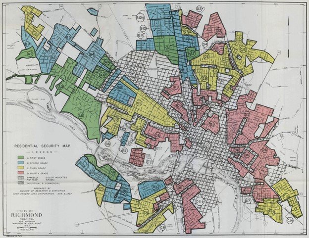
This is a redlining map of Richmond, Virginia. In the 1930’s, the U.S. federal government officially promoted discrimination in housing by allowing the Home Owners’ Loan Corporation to represent predominantly Black communities on such maps in red to classify them as “risky” for investors. This resulted in funding being steered away from these communities. Today this means there are fewer green spaces in redlined areas. Emerging from this is an average heat about 5 degrees hotter than the surrounding communities. In redlined communities without parks, mostly covered in asphalt and concrete, the heat soaks into the ground and radiates heat outwards. As global warming continues, heat waves become worse for members of these communities and pose serious health risks. Label by Annabelle Marcais